

Section 02 · Identifying Connection Priorities
Method2.2
Designate Priority Areas
Take the connection objectives one at a time. For each, combine its indicators into a single score for every unit the catchment is divided into (cells, block groups, or zones), find where the highest-scoring units cluster, and designate the places that warrant diagnosis as named Priority Areas. The score is evidence; the designation is a judgment made against it.
One pass per objective
- Set the threshold
Start with the top 5% of units, then tighten or loosen it (10%, 5%, 2.5%, 1%) until the qualifying units form a handful of distinct places. Adjust it for selectivity, never to capture a particular place.
- Group by context
Group qualifying units that share one transportation, land-use, or neighborhood context into an area, and name it for that context. Include adjoining units from the same context even if they don't qualify.
- Extend before adding
On later passes, where qualifying units overlap or adjoin an existing area, extend it and add the objective to its designations. Create a new area only for a new context.
Flux walkthrough2.2
Designate areas, one objective at a time
Colorado Connector Fort Collins, Colorado · NFR 2045
Read the index and designate
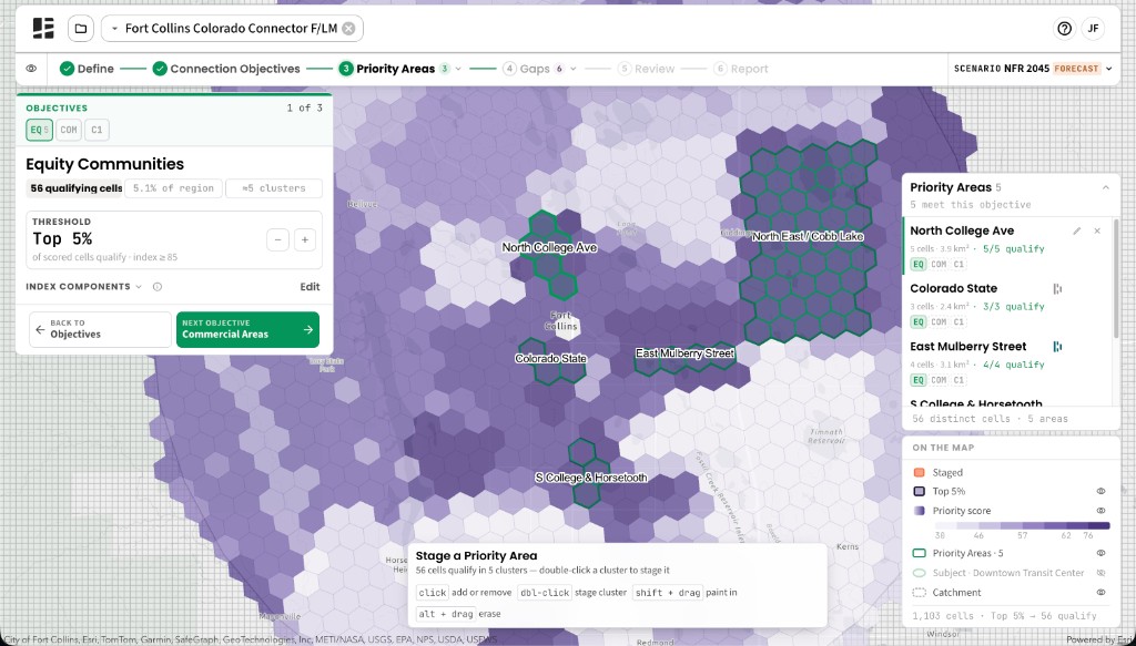
The Priority Areas stage takes the objectives in order and scores the catchment with one index at a time, outlining the cells that qualify at the current threshold. Clicking a cell selects it, double-clicking a cluster selects all of it, and naming the selection creates the area.
Our first pass, Equity Communities at the default Top 5%, qualified 56 cells in about five clusters. Reading them against our knowledge of Fort Collins, we designated five areas: Colorado State, the East Mulberry Street corridor, North College Ave, S College & Horsetooth, and the rural and suburban fringe to the northeast, which we named North East / Cobb Lake.
Extend or add areas with each pass
Existing areas stay on the map through every pass. Commercial Areas pointed to the same corridors, so we extended East Mulberry Street and North College Ave slightly and added East Harmony Drive. CoCo Station Area Travel, tightened to Top 2.5%, extended several areas and added a few we judged distinct, such as S College Ave South of Downtown. Job Centers reinforced the commercial corridors, especially along College Ave, and picked out large office and manufacturing centers such as Midpoint Drive and East Harmony Drive.
Finish the set
The Connectivity Analyzer records each area as it’s made. We finished with 11 Priority Areas.
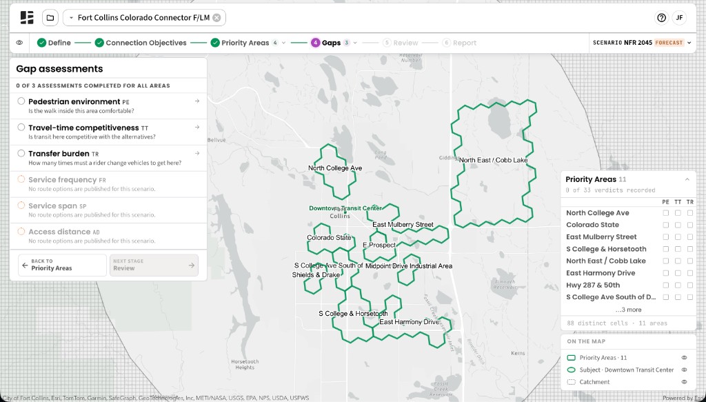
The completed set entering the Gaps stage, from North East / Cobb Lake at the catchment's edge to East Harmony Drive in the south.